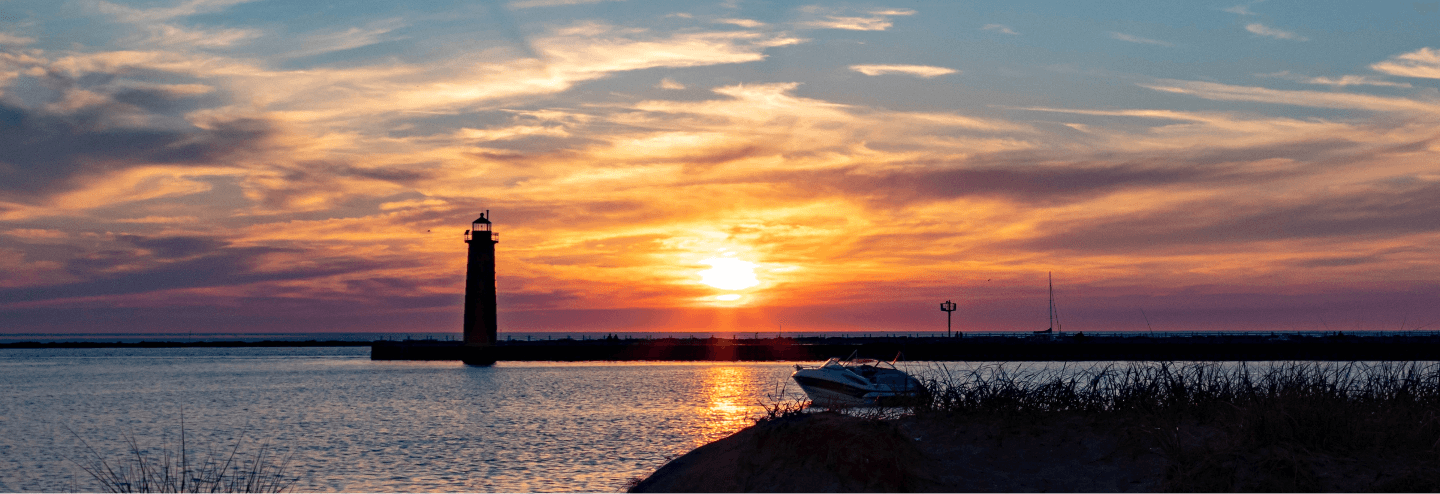
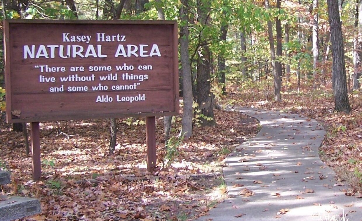
Kasey Hartz Natural Area
Kasey Hartz Natural Area
Muskegon, MI 49442
Hours of Operation
Mon-Sun
Dawn to Dusk
Campus Email:
Office Location
1411
An Instructor’s Legacy
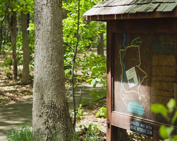
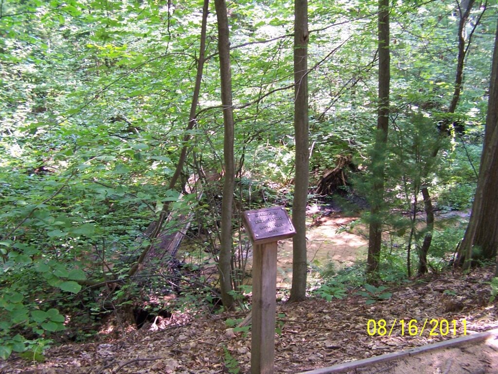
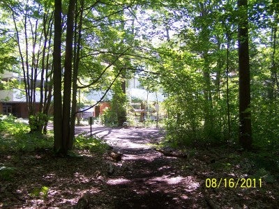
Kasey Hartz Natural Area is named in honor of Mary Kathryn “Kasey” Hartz, a biology instructor from 1958-1973. The area includes a Nature Trail that is open to the public, clubs, organizations, and educational groups. The Main Trail Loop is approximately one mile with the first 600 feet wheelchair accessible. There is a more difficult and less well-marked Arbutus Loop. Four Mile Creeks run through the area and two bridges on the trail cross over the creek. Three distinct habitats are encountered. Individuals and groups can use the numbered markers for a self-guided tour. Reference sheets for the various plant species encountered along the trail are among the many resources available. Muskegon Community College also maintains an herbarium (add link to herbarium page) within the Life Sciences Department. For guided tours and inquiries about using the space for research projects contact the Life Sciences Department at 231-777-0273.
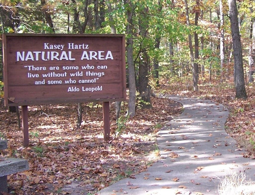
Brief History of Kasey Hartz Natural Area
Originally an area of approximately 10 acres was established officially as the Natural Area by the Board of Trustees of Muskegon Community College in May 1970. Later this area, which is adjacent to the campus proper was surveyed and delineated as 15 acres, includes a buffer zone, and again was recognized by the Coordinating Council on March 25, 2008. When including the additional wooded property surrounding the designated Nature Trail system, the total area approaches 30 acres. The Board of Trustees of Muskegon Community College is to be commended for its foresight in establishing such as area and for recognizing the value of a natural area in the academic program at the college.
“We hope that this service of the College to the community will help to create a greater awareness and appreciation of the natural environment and a real sense of responsibility to work toward environmental quality for the Muskegon community. Here, one can learn firsthand the inter-relationships between the physical and biological aspects of the environment and better understand our relationship to the whole ecosystem. It is a place for aesthetic enjoyment and appreciation of natural systems.” – Kasey Hartz
Planning Your Visit
- Visit Kasey Hartz Natural Area
- Purpose of the Natural Area
- Overview of the Nature Trails
- Find the Nature Trail on MCC Campus
- Driving Access
- Virtual Tour
- Species Fact Sheets A-J
- Species Fact Sheets K-Z
- Herbarium
VISIT KASEY HARTZ NATURAL AREA
The natural area and trails are suitable for use by college, K-12 school aged children, scouts, church groups, and other interested community members anytime during the daylight hours. Walking time, allowing for looking, listening, and reflecting, is about one hour; although if using the trail for a quick walking break, a loop can be walked in about fifteen minutes. Although the first 600 feet of the trail is concrete and is wheel chair accessible, the trail is not maintained during the winter and walking on the trail is not recommended unless there is no snow cover.
Reservations for trail guides can be made by calling the Life Science Department at 231-777-0273 or email naturetrailreservations@muskegoncc.edu. Reservations should be made at least three weeks in advance. Groups should be no larger than 25 and larger groups will be split into smaller groups. Trail guides are trained by the Life Science Department faculty and are many times college students who are appreciative of advanced group reservations.
Spring tours are available beginning the middle of April through June and autumn tours can be requested from September through October. All tours are contingent on the weather; so be prepared for a tour cancellation if there is rain since the boardwalks and stairways become very slippery when wet. If your group would like to visit but do not need a trail guide, please call the Life Science Department secretary if you are bringing a group larger than ten people to avoid conflicts with other groups. When visiting the trail, many groups take advantage of the free showings at our Planetarium but appointments must be made for the Planetarium.
See below for more information if you want to be a trail guide or contact the LS department 231-777-0273.
Purpose of the Kasey Hartz Natural Area
- To conserve a portion of the College campus that is representative of the natural communities and beauty of west Michigan.
- To provide a nature trail for the enjoyment of students, faculty and the community where individuals can develop an appreciation of the harmony that can exist between humans and the land.
- To provide an area where children can learn to develop a sense of appreciation and respect for the living world.
- To develop in those who use the area an understanding of interrelationships that exist in natural communities.
- To provide an outdoor laboratory where students can acquire knowledge of ecological principles and develop scientific curiosity.
- To provide an outdoor laboratory for the enrichment of courses within the College, such as art, biology, geology and geography.
- To provide an area for the enjoyment of hiking, bird watching and photography.
Overview of the Nature Trails
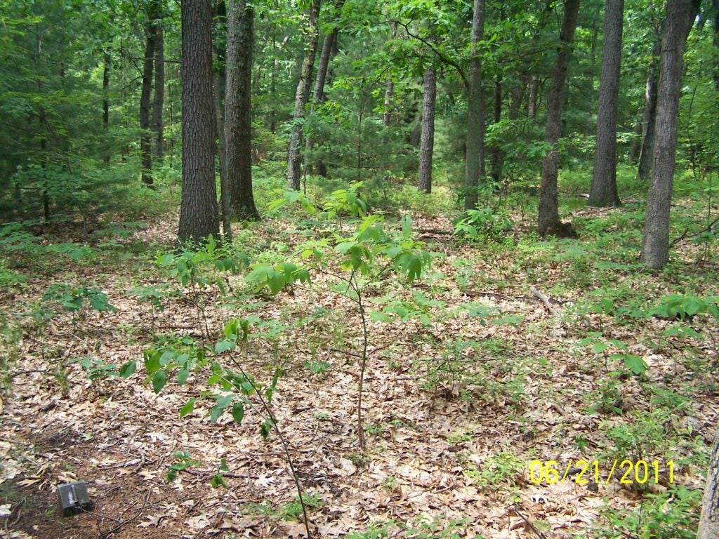
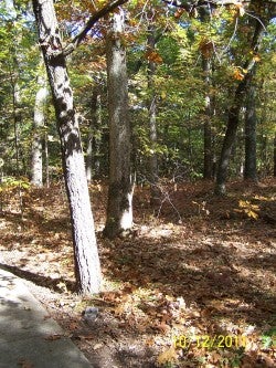
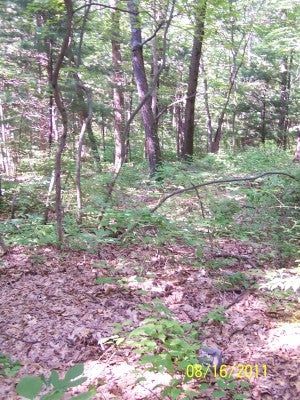
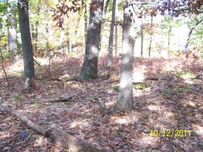
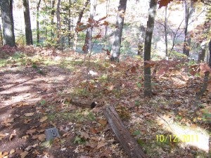
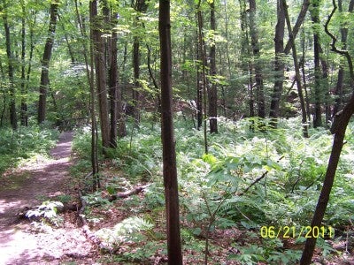
The trail meanders through three distinct types of habitats. It winds among the oaks and pines of the upland, before turning south to cross the creek, then goes up a north facing slope before turning east to overlook the creek from the south side. It then winds down into the creekbed again, crossing the creek and a small transition zone before climbing the south facing slope to the end. The first part of the trail goes through the upland area covered with oak-pine woods such as is quite typical in south-eastern Michigan. The soil is mostly sand with a layer of one-three inches of humus. As you descend the trail into the creek bed, you will be aware of some distinct changes. These changes are due to the effect of differences in temperature and humidity. Associated with these changes in the physical environment are changes in the organisms making up another community in another habitat—the creekbed wetland habitat. The number and species of organisms have increased. The third change in habitat is seen as one ascends the north facing slope and follows the trail eastward. Red maple and witch-hazel trees are quite common and seem to be replacing the oak-pine association on the north side of the creek.
The plants, animals, protists, bacteria, and fungi which live in the communities in these habitats have been shaped by forces of the past and present – in recent geological time, the glaciers which retreated from this region about 10,000 to 15,000 years ago; to more recent time, lumbering by removal of the red and white pine trees; the changing soils; fires; the dynamic effect of Lake Michigan; the inter-relationships of organisms through eons of time; and additional anthropogenic effects by humans in our choice of a place to live and our use of the land.
You will enjoy your walk more if you try to think in terms of communities, in which each organism, regardless of size or number, has a particular part to play (niche) and must perform it well enough to survive and reproduce. That its profession or job is necessary if the community is going to function. Nothing is static here; something is always happening. The community is a dynamic one. Each organism has its function, living or dead. The trail with its numbered stations indicates some specific representative organisms particularly plants and it is hoped that you think of the relationships and inter-relationships between the members of the living community and the non-living factors of the environment. This is the ecological concept.
How To Find the Nature Trail on the MCC Campus

Driving Access
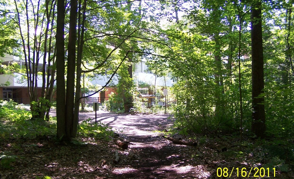
Driving access to the Kasey Hartz Natural Area on the campus of Muskegon Community College (221 E. Quarterline Road, Muskegon, MI 49442) is obtained by parking in the North Parking Lot off of Quarterline Road and walking toward and along northern side the automobile technology wing to the trailhead located just northwest of the building. If already on campus, the trailhead is located from the main first floor. Exit the building from the outside doors just east of the Chemistry Laboratories and follow the sidewalk to the north / northeast (away from the inner courtyard live roof area) until you see the trailhead to your left.
Virtual Tour
Species Reference Sheets
Kasey Hartz Natural Area Habitat and Species Fact Sheets (including some dune and prairie species)
Completed by independent study students and edited by T. Van Veelen, Nov. 2011.
Photographs by students and T. Van Veelen
 Barberry (Berberis) by student Andrew Carson 2011
Bearberry (Arctostaphylos uva-ursi) by student Andrew Carson 2011
Beech, American (Fagus grandifolia) by student Andrew Carson 2011
Blueberry, low (Vaccinium angustifolium) by Barbara Grob 2007
Bluestem, big (Andropogon gerardii) by student Hope Buell 2010
Bluestem, little (Schizachyrium scoparium) by student Andrew Carson 2011
Cherry, black (Prunus serotina) by student Hope Buell 2010
Cucumber root, indian (Medeola virginiana) by Barbara Grob 2007
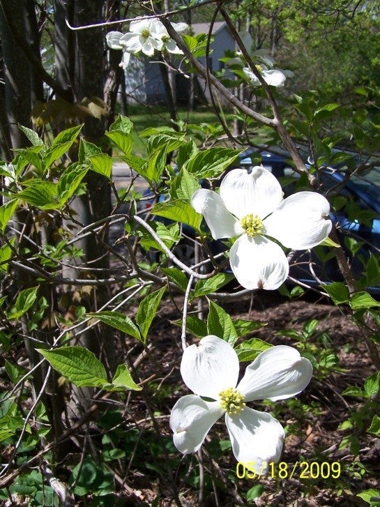
Dogwood, flowering (Cornus florida) by student Barbara Grob 2008
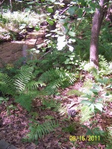
Fern, bracken (Pteridium aquilinum) by student Elizabeth LaRue 2008
Fern, cinnamon (Osmunda cinnamomea) by student Elizabeth LaRue 2008
Fern, royal (Osmunda regalis var. spectabilis) by student Elizabeth LaRue 2008
Fern, sensitive (Onoclea sensibilis) by student Elizabeth LaRue 2008
Goldenrod (Solidago) by Barbara Grob 2007
Grape (Vitis) by student Hope Buell 2010
Greenbrier (Smilax rotundifolia) by student Barbara Grob 2008
Ground pine (Lycopodium obscurum) by Barbara Grob 2007
Habitat: Creek Bed by student Barbara Grob 2008
Habitat: Environmental data, winter 2008 by Barbara Grob and Elizabeth LaRue 2008
Habitat: Red Maple/witch-hazel (North-facing slope) by student Barbara Grob 2008
Habitat: Sampling procedures by Barbara Grob 2008
Habitat: Upland by student Barbara Grob 2008
Hepatica, round lobed (Hepatica americana) by student Barbara Grob 2008
Hepatica, sharp lobed (Hepatica acutiloba) by student Barbara Grob 2008
Horsetail (Equisetum) by student Hope Buell 2010
Huckleberry(Gaylussacia baccata) by Barbara Grob 2007
Jack in the pulpit (Arisaema triphyllum) by Barbara Grob 2007
Jewelweed (Impatiens pallida) by Barbara Grob 2007
Barberry (Berberis) by student Andrew Carson 2011
Bearberry (Arctostaphylos uva-ursi) by student Andrew Carson 2011
Beech, American (Fagus grandifolia) by student Andrew Carson 2011
Blueberry, low (Vaccinium angustifolium) by Barbara Grob 2007
Bluestem, big (Andropogon gerardii) by student Hope Buell 2010
Bluestem, little (Schizachyrium scoparium) by student Andrew Carson 2011
Cherry, black (Prunus serotina) by student Hope Buell 2010
Cucumber root, indian (Medeola virginiana) by Barbara Grob 2007
Dogwood, flowering (Cornus florida) by student Barbara Grob 2008
Fern, bracken (Pteridium aquilinum) by student Elizabeth LaRue 2008
Fern, cinnamon (Osmunda cinnamomea) by student Elizabeth LaRue 2008
Fern, royal (Osmunda regalis var. spectabilis) by student Elizabeth LaRue 2008
Fern, sensitive (Onoclea sensibilis) by student Elizabeth LaRue 2008
Goldenrod (Solidago) by Barbara Grob 2007
Grape (Vitis) by student Hope Buell 2010
Greenbrier (Smilax rotundifolia) by student Barbara Grob 2008
Ground pine (Lycopodium obscurum) by Barbara Grob 2007
Habitat: Creek Bed by student Barbara Grob 2008
Habitat: Environmental data, winter 2008 by Barbara Grob and Elizabeth LaRue 2008
Habitat: Red Maple/witch-hazel (North-facing slope) by student Barbara Grob 2008
Habitat: Sampling procedures by Barbara Grob 2008
Habitat: Upland by student Barbara Grob 2008
Hepatica, round lobed (Hepatica americana) by student Barbara Grob 2008
Hepatica, sharp lobed (Hepatica acutiloba) by student Barbara Grob 2008
Horsetail (Equisetum) by student Hope Buell 2010
Huckleberry(Gaylussacia baccata) by Barbara Grob 2007
Jack in the pulpit (Arisaema triphyllum) by Barbara Grob 2007
Jewelweed (Impatiens pallida) by Barbara Grob 2007
Species Reference Sheets
Kasey Hartz Natural Area Habitat and Species Fact Sheets (including some dune and prairie species)
Completed by independent study students and edited by T. Van Veelen, Nov. 2011.
Photographs by students and T. Van Veelen
Liverwort (Phylum Hepatophyta) by student Elizabeth LaRue 2008
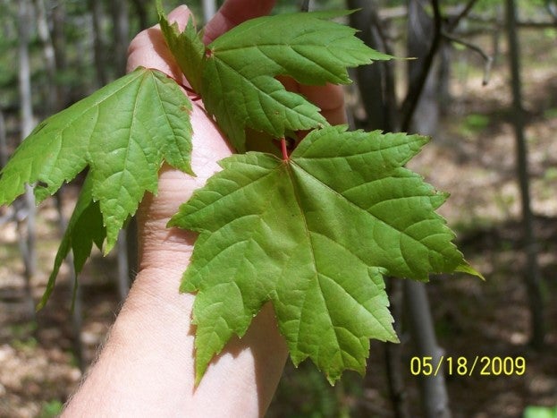
Maple, red (Acer rubrum) by student Barbara Grob 2008
Maple, sugar (Acer saccharum) by student Andrew Carson 2011
Marsh marigold (Caltha palustris) by Barbara Grob 2007
Mayapple (Podophyllum peltatum) by student Elizabeth LaRue 2008
Mayflower, Canada (Maianthemum canadense) by Barbara Grob 2007
Oak, black(Quercus velutina) by student Barbara Grob 2008
Oak, red (Quercus rubra) by student Barbara Grob 2008
Oak, white (Quercus alba) by student Hope Buell 2010
Partridgeberry (Mitchella repens) by Barbara Grob 2007
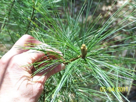
Pine, white (Pinus strobus) by student Barbara Grob 2008
Poison ivy (Toxicodendron radicans) by Barbara Grob 2007
Sassafras (Sassafras albidum) by student Barbara Grob 2008
Shelf fungi (Phellinus) by student Hope Buell 2010
Skunk cabbage (Symplocarpus foetidus) by Barbara Grob 2007
Solomon seal (Polygonatum pubescens) by student Barbara Grob 2008
Spicebush (Lindera benzoin) by student Barbara Grob 2008
Starflower (Trientalis borealis) by Barbara Grob 2007
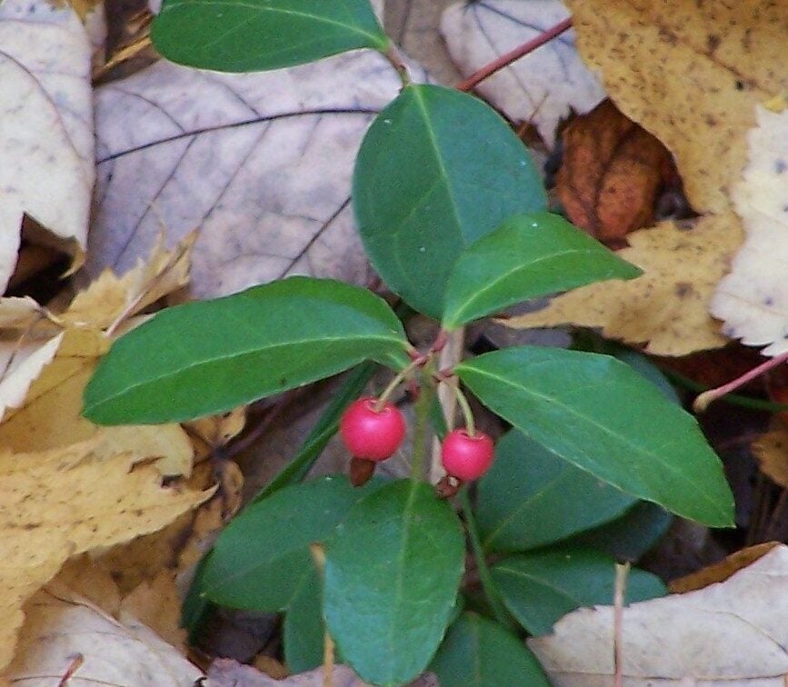
Wintergreen (Gaultheria procumbens) by Barbara Grob 2007
Witch-hazel (Hamamelis virginiana) by Barbara Grob 2007
Bibliography for Andrew Carson’s fact sheets 2011
Bibliography for Barbara Grob’s fact sheets 2008
Bibliography for Elizabeth LaRue’s fact sheets 2008
Bibliography for Hope Buell 2010
Herbarium
Muskegon Community College Herbarium is in the Science Center Room 1415
Many plant specimens from the Kasey Hartz Natural Area and from surrounding West Michigan areas are preserved in the Muskegon Community College Herbarium located in the Science Center. Some of the specimens have been specifically constructed for students and are utilized by the college students for in our biology courses.
Brief Historical Information about Herbarium Collectors
The Muskegon Community College Herbarium has specimens dating from 1894 to the present day with a total of 1676 specimens. Collectors included Cal Scott from West Bend, Wisconsin in 1974; MCC student Kathy Anderson in 1968; Reverend Clinton Frank of Hope College in 1917, and MCC student Engelien de Bruin in 1987, who now teaches in the Netherlands. Other major collectors were the following:
- Eric A. Bourdo, Jr (1917-1995) collected most of his specimens in 1974. After completing his degrees from Michigan Technological University, and the University of Michigan (PhD in forestry), Eric worked as a consultant for many wood product companies, as well as being a professor at Ford Forestry Center (1958-1981) and Michigan Technology University 1947-1958. He authored many articles and a guidebook on trees.
- Hazel Roach Delcourt attended MCC in 1968-1969 and then graduated from Albion College in 1972. She later completed a Master’s degree in botany from Louisiana State University (1974) and earned her PhD in ecology from the University of Minnesota (1978). Hazel also served as secretary of the Ecological Society of America from 1986-1992 and retired as a full professor from University of Tennessee in Knoxville. She and her husband wrote many articles and books on forestry, ecology, and paleoecology.
- Mary Kasey Hartz (1908 – 2001) taught in MCC’s Life Sciences Department from 1958-1973. She and her students established the campus’ natural area and trails in the 1970s. In 2003, new trail boardwalks were constructed from funds bequeathed by her. Kasey was dearly loved by many people who enjoyed her as a trail guide not only here but also at Hoffmaster State Park. She graduated from College of St. Teresa in Winona, Minnesota in 1929. Teaching at a variety of different high schools, junior schools, and colleges, she completed her Master’s degree from the University of Minnesota in 1952 with a focus in aquatic ecology. A book of her poetry was published by Jim and Jane Kane in 2001 (Kasey Hartz: Poetry and Biography. Muskegon Community College).
- The D. McLouth specimens range from 1890s – early1900s. Many of these fragile herbarium sheets are annotated and noted by Dr. Edward Voss, (deceased) curator of University of Michigan Herbarium for the 1966 Michigan Flora Project. Clarence D. McLouth (1860-1932) was a science teacher, head of the Muskegon High School’s Natural Science department, and contributed to the Michigan Flora prepared by W. J. Beal in 1904. Clarence was instrumental in establishing the “Garden Boys” in Muskegon around 1914. Young students were given a small parcel of garden to plant and maintain on the outskirts of Muskegon Heights. Garden yields were eaten or sold. Some of his contemporaries wrote this about Clarence: “He is a widely recognized authority on all of the native flora and bird life, and gives his boys much valuable information about insects and plant life. He teaches them to enjoy, protect, and preserve both the wild flowers and all bird life in any form.” Collins & McMillan. 1915. Kalamazoo Normal Record (1910-1918). Western Michigan University.
- Roy Struven (1925-1999) was the planetarium technician and taught Celestial Navigation, Electronic Math, and Acclimatization Workshop at Muskegon Community College during 1975- 1988. He collected many plant specimens during his tenure.
- Theresa Van Veelen, with field assistance from MCC student Barbara Grob, collected over 500 plant specimens for the herbarium and course materials during her first sabbatical in 2010. Theresa graduated from Grand Valley State University in 1993, with a biology degree and an emphasis in botany and later completed a Master’s degree in Zoology from Michigan State University in 1999. She has been teaching full-time in MCC’s Life Sciences Department since 1999. During the Fall 2016, she categorized and imaged all herbarium sheets for digital viewing online as part of the Consortium of Midwest Herbaria.
Exploring The Kasey Hartz Trail
- Trail Map
& Brochure - Trail Markers
1-4 Facts - Trail Markers
5-10 Facts - Trail Markers
11-13 Facts - Trail Markers
14-16 Facts - Trail Markers
17-20
Trail map Information & Brochure

The trail meanders through three distinct types of habitats. It winds among the oaks and pines of the upland, before turning south to cross the creek, then goes up a north facing slope before turning east to overlook the creek from the south side. It then winds down into the creek bed again, crossing the creek and a small transition zone before climbing the south facing slope to the end. The first part of the trail goes through the upland area covered with oak-pine woods such as is quite typical in south-eastern Michigan. The soil is mostly sand with a layer of one-three inches of humus. As you descend the trail into the creek bed, you will be aware of some distinct changes. These changes are caused by the effect of differences in temperature and humidity. Associated with these changes in the physical environment are changes in the organisms making up another community in another habitat—the creek bed wetland habitat. The number and species of organisms have increased. The third change in habitat is seen as one ascends the north facing slope and follows the trail eastward. Red maple and witch-hazel trees are quite common and seem to be replacing the oak-pine association on the north side of the creek.
The plants, animals, protists, bacteria, and fungi which live in the communities in these habitats have been shaped by forces of the past and present – in recent geological time, the glaciers which retreated from this region about 10,000 to 15,000 years ago; to more recent time, lumbering by removal of the red and white pine trees; the changing soils; fires; the dynamic effect of Lake Michigan; the inter-relationships of organisms through eons of time; and additional anthropogenic effects by humans in our choice of a place to live and our use of the land.
You will enjoy your walk more if you try to think in terms of communities, in which each organism, regardless of size or number, has a particular part to play (niche) and must perform it well enough to survive and reproduce. That its profession or job is necessary if the community is going to function. Nothing is static here; something is always happening. The community is a dynamic one. Each organism has its function, living or dead. The trail with its numbered stations indicates some specific representative organisms particularly plants and it is hoped that you think of the relationships and inter-relationships between the members of the living community and the non-living factors of the environment. This is the ecological concept.
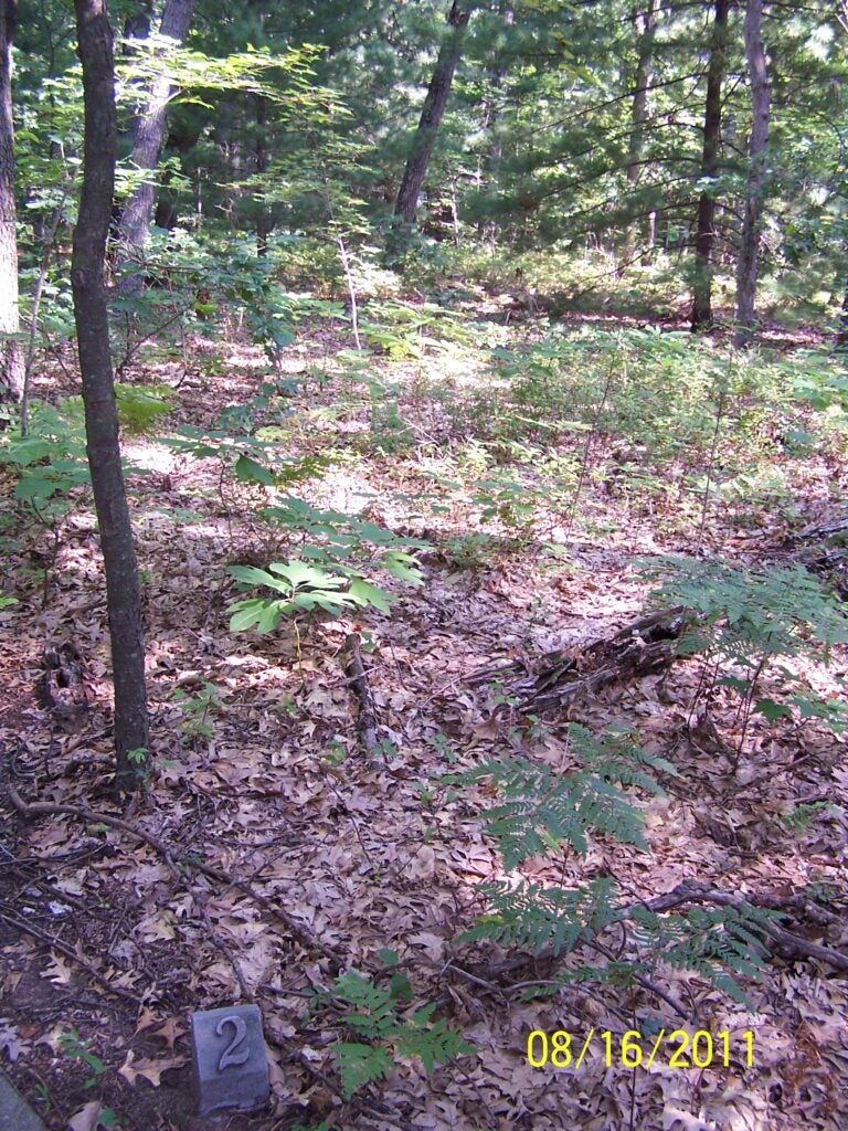
Trail Markers 1-4 Descriptions
Upland Oak – Pine Fact Reference Sheet Habitat: Upland Reference sheet
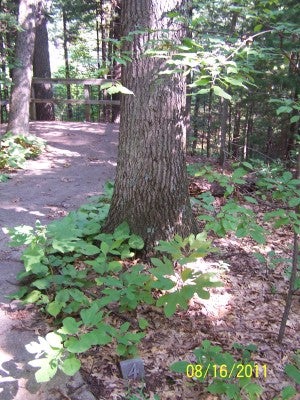
Trail Marker 1 : Oak Trees
Post 1: Representative of the dominant trees are white oak Quercus alba), with its lighter bark and black oak (Quercus velutina), red oak (Quercus rubra), with their darker bark.
White oak has leaves that have rounded lobes and the bark of a mature tree is a light grey. The fruit, an acorn which ripens in the fall, provides food for animals, such as chipmunks, red squirrels, birds, and deer. Red and black oak have leaves with lobes which are sharply pointed and bristle-tipped. Our state tree, white pine (Pinus strobus) is intermingled with the oaks and can be identified from its bundle of five needles. White pine is susceptible to a fungus disease, white pine blister rust. The fungus requires two hosts, the pine and wild currant or gooseberry. Where the disease is prevalent, currants or gooseberries, the alternate hosts, are eradicated.
Stay on the cement path to go on to post #2. You may notice a dirt path to the left (south) between trail post #1 and #2. This is a shortcut trail that returns from the end of the trail.
Trail Marker 2: Black Cherry
Post 2: Between trail post #1 and #2, you may notice a smaller tree with black flakey bark; black cherry, (Prunus serotina), doesn’t grow tall in this area. It can be identified by looking for orange hairs which are along the mid-rib vein on the underside of the leaves. This species attains a much greater size in the creek bed habitat. Amelanchier, juneberry, can be seen in a few places near the trail. It is a tall shrub which has white blossoms in late April or early May and bears fruit near the end of June. The fruit is excellent food for wildlife and even for jam/jellies. Easily recognizable is sassafras (Sassafras albidum) by its three different shaped leaves. It is a member of the laurel family and here it does not attain tree size due to limiting factors. The fruit, dark berries, and roots furnish food for animals and humans. Rub the bark off of a small twig and smell it. The spicy “root beer” flavor and aromatic odor is very pleasing to most people.
Trail Marker 3: Huckleberry Bush
Post 3: The small bushes are huckleberry (Gaylussacia baccata) and blueberry (Vaccinium angustifolium) and make up much of the shrub cover in the oak-pine habitat. Huckleberry has orange resin spots on the backside of its leaves and blueberry has smaller darker green leaves. Both of these plants furnish edible fruit for birds and small mammals. Do not be surprised if you see some chipmunks, red squirrels or fox squirrels scampering across the trail. Also common before frost is bracken fern (Pteridium aquilinum) which is the only species of fern in the oak-pine habitat. This fern with its long underground rhizomes sending up three-parted fronds is commonly found in partially open wooded uplands. Do you know of some yard where it also grows? Many old wives’ tales exist about the bracken fern: it protects one from goblins and witches and drives away serpents, gnats, no see ums (fly midges), and other creatures.
Trail Marker 4: White Pine
Post 4: Look around. Do you see the largest white pine trees, most likely a remnant of the past lumbering years 150-200 years ago when it was too little and young to have been cut. No doubt they are the mother seed trees for all younger white pine trees around it. Since some are larger than the oaks, the pines also probably preceded the oaks in the natural plant succession. White pine might be said to be the species that built Muskegon, since millions of feet of lumber came down the Muskegon River to the sawmills lining the shores of Muskegon Lake. The heart-shaped leafed aster (Aster macrophyllous) blooms in the fall with a lovely blue purple flower. Also blooming in the fall is the blue stemmed goldenrod (Solidago caesia) which you may have noticed as you walked along the trail. As you proceed along the trail, notice the oak on the right hand side that has been infected with a shelf fungus (Phellinus) which obtains its nutrients by sending growing threads (mycelia) into the decomposing wood.
Trail Markers 5-10 Descriptions
Trail Marker 5: Dogwood Tree
Post 5: Take a short spur off to the left to find this trail post at the flowering dogwood tree (Cornus florida). This is one of Michigan’s loveliest trees with it large white blossoms before leafing out in the spring. In the fall, the leaves turn red and add much to the color and beauty of the woods. Listen! You may hear the cardinal singing. Turn back to where you previously were (if you continue downhill you will join the trail loop near its end). If you are with a guide, be certain to dig the soil probe down into the ground so that you can see, feel, and smell the upland soil. This soil type is Grayling-Rubicon sands, which is an excessively drained soil formed from the sandy deposition of glacial outwash 10,000s years ago.
Trail Marker 6: Greenbrier Plant
Post 6: Have you heard or seen any animals yet? Be careful around the bend, the sharp spines along the stems of greenbrier (Smilax) which are along the trail may snag you. On the rotting logs lying on the ground, you may see wood that appears to be colored with a green marker which is really a fungus called Chlorosplenium or also known as Chlorociboria.
Trail Marker 7: Ground Cover
Post 7: Can you recall the names of the trees in this location? Which tree is white pine? Which is white oak? During the 1970s this area was more open than it is now due to lumbering and fires. Previously the area was dry and mostly barren except for mosses and lichens which are pioneer species in the natural plant succession. As time progressed so does succession. After the mosses and lichens, small shrubs such as blueberry and huckleberry were able to survive and later larger shrubs and trees. If you are willing to be quiet, observant, and also lucky, you may see some small mammals in this area. See if you can find “runways” of the white footed deer mouse which is often near or in the path.
Trail Marker 8: View From A Slope
Post 8: Here is a place to ponder about some of the things that humans do to our environment and see some of our anthropogenic effects. Look down the slope to the north. Some time prior to 1970s about 600 tons of soil eroded from this slope and formed a delta pushing into the creek bed. Then unfortunately in 2004, a new sewer system greatly disturbed the ravine, but it is proposed to be planted as a Michigan prairie with hopes of seeing the flowers of lupines and bird’s foot violet again on this campus. Presently some trail users have been using this eroding trail furthering its damage. Fox tracks have been observed during the winter in this area even though the red fox (Vulpes vulpes) hasn’t been observed. This bold beautiful animal is a predator on insects, mice, and may feed occasionally on cottontail rabbits.
Trail Marker 9: Witch-Hazel Near The Bench
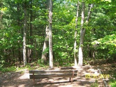
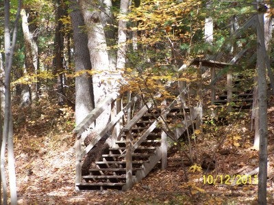
Post 9: Rest for a while on the bench at The Point under the arching branches of witch-hazel (Hamamelis virginiana) and listen to the sounds and calls of birds, frogs, toads, insects, squirrels and other animals. Below you is a low wet area with many wetland plants. This is where Four Mile Creek and an intermittent stream meet to flow as one into the Muskegon River. The low puddled areas formed in the spring in the wetland area make good breeding places for frogs and toads. Listen for the beep, beep of the little spring peeper (Pseudacris crucifer crucifer). You may also hear the trilling of the male American toad (Bufo americanus americanus) or the deep throated call of male green frogs (Rana clamitans melanota) as they try to attract the females to this breeding area. Blue jays, flickers, orioles, cardinals, chickadees, as well as other birds may be heard at all times of the year. As you continue down the trail and stairway, be careful especially when they are wet with dew or other forms of precipitation.
At the bottom of the steps, you may take the short trail to the right on an old roadway to see the proposed prairie area and then return.
Trail Marker 10: Wildflower Wooded Area
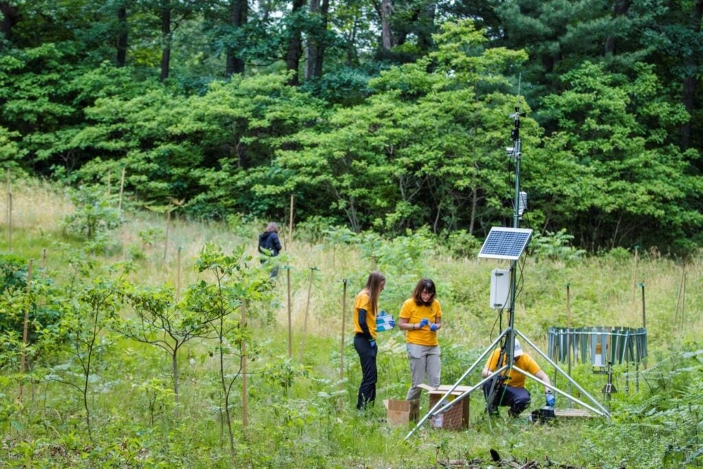
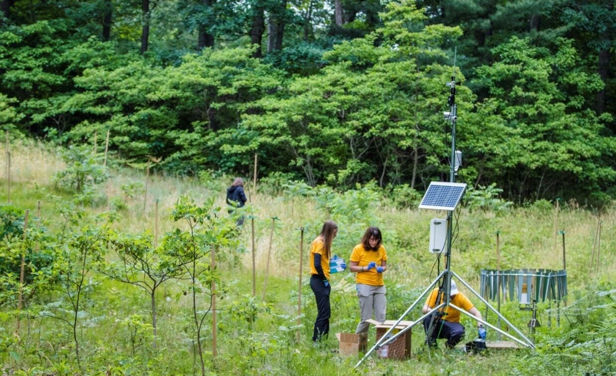
Post 10: The point at 10 overlooks a less wooded area, covered with herbaceous field plants such as wildflowers. This is a proposed prairie area for pollinator plants. Research students from Grand Valley State University (GVSU) Annis Water Resources Institute collaborated with Muskegon Community College (MCC) to complete ecological research in this area by collecting environmental DNA.
Trail Markers 11-13 Descriptions
Trail Marker 11: Wetland Area Plantings
Post 11: Have you noticed a change in the temperature and humidity as you walk in the wetland area and approach Four Mile Creek? You should also be aware of distinct changes in the vegetation. Some of the surrounding plants may be also found in dry areas, but many are only obligate wetland species. Near the path are blackberries (Rubus spp.) and horsetail (Equisetum). Do you see the miniature “Christmas trees” about 10 centimeters tall to the right of the trail? These are not pine trees at all, but Lycopodium – common name is clubmoss, but it is not a moss either! These are simple plants more closely related to ferns than flowering plants. Do not pick these plants even though they have been used for decorative purposes; they are now protected in Michigan. Maturing in about 25 years, a clubmoss plant may only become eight inches tall! Another plant in this area is Jack in the pulpit (Arisaema triphyllum). Its red berry-like fruit form under the hood of its leaf during the summer. Spicebush (Lindera benzoin) grows along the trail here as a small shrub. Look for the small dots on its bark and its early spring yellow flowers. Try rubbing and smelling a small piece of its bark; most people find the smell very pleasant and spicy.
Trail Marker 12: Cinnamon Fern
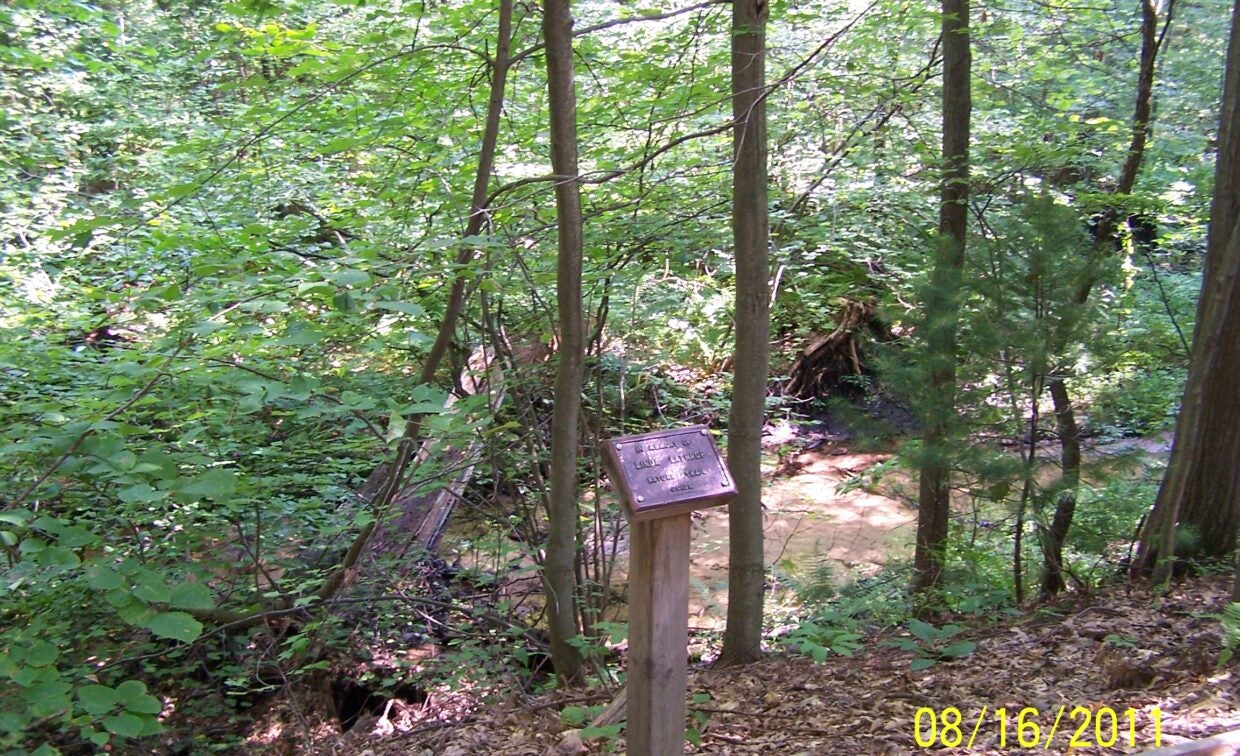
Post 12: Four Mile Creek begins near Sheridan Road, is about three miles long with its watershed as mostly residential land use with some industry. The immediate habitat supports many wetland plants such as skunk cabbage (Symplocarpus foetidus), Jack in the pulpit (Arisaema triphyllum) and cinnamon fern (Osmunda cinnamomea). The creek at this place is quite clear and shallow. There is, however, evidence of disturbance (fresh sand load on the bottom of the creek) due to scouring and erosion.
In the spring, skunk cabbage is one of the first flowers to appear, sometimes even before the snow is gone. If you smell the flower or its large leaves, you will soon know how the plant received its common name. The cinnamon fern is an interesting fern since it bears separate sterile and fertile fronds. The central portion or heart of all Osmunda spp. is tender, crisp and edible, tasting much like raw cabbage. It is easily obtained by pulling up a clump of half developed fronds. Do NOT try this delicacy since pulling up the clump of fronds will destroy the whole plant and there are other similar looking ferns that may cause gastric illnesses.
Do another soil probe digging to observe the wetland soils. How does its smell, texture, and color compare to the upland soil? Two types of wetland soil types exist in this floodplain area: Saranac loam and Tawas/Carlisle mucks. Both of these soil types are very deep and poorly drained organic soils.
In early May, this area is also covered with large patches of mayapple or mandrake (Podophyllum peltatum). The mayapple bears an unpleasant smelling white flower in the fork between the pair of large umbrella shaped leaves. The mature edible fruit of this plant is a fleshy, yellowish, egg-shaped, many seeded “apple” about two inches long. Some people find it a pleasant food item but beware it may give intestinal illness if it is not ripe. The root has been used medicinally for many years, but may also cause gastric illnesses. Other small plants are Canada mayflower or false lily of the valley (Maianthemum canadense) and goldthread (Coptis trifolia) giving the appearance of a miniature forest. Goldthread gets its name from its orange-colored roots and is a small evergreen plant with three-lobed leaves. Its tiny star-shaped flower appears in early spring.
As you cross the bridge, pause to look into the water. You may see frogs, tadpoles, fish, or water striders. Do you see little twigs moving on the bottom of the creek? These are probably the larva of caddis flies which build homes of twigs, sand and other available materials in which they live until they mature. Water striders are insects that skim over the surface of the water. You may see a few small fish in the pools. Growing on the logs near the stream are mosses and liverworts which are very simple plants with no true roots or stems.
Trail Marker 13: Wintergreen & Partridgeberry
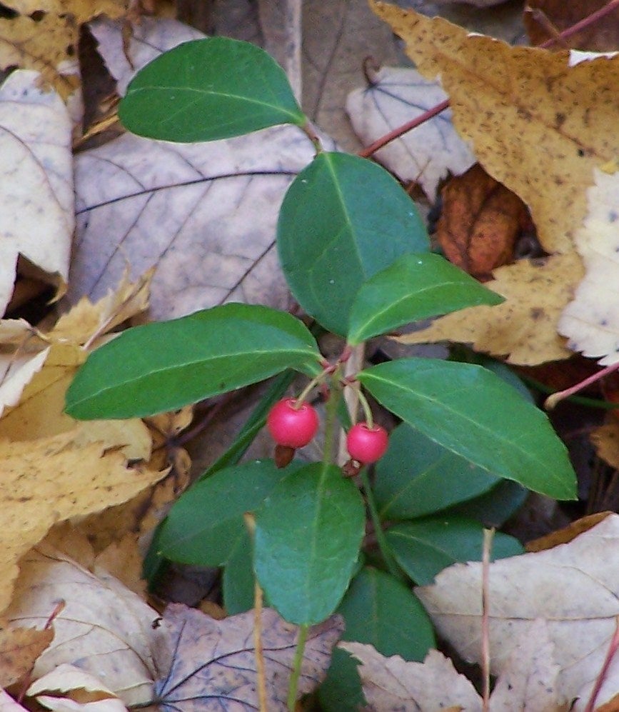
Post 13: Do you see the two small plants that form red berries in the autumn? Wintergreen (Gaultheria procumbens) is larger than the creeping partridgeberry (Mitchella repens). Wintergreen is a low creeping evergreen shrub and makes up much of the ground cover in this area. It is usually abundant in rich coniferous woods and is a good indicator of the fact that soil conditions at the present time are not much different than when white pine was the dominant tree in the area. Partridgeberry is also a low trailing plant with paired fragrant flowers developing into small red fruits if they are not eaten by animals.
Trail Markers 14-16 Descriptions
Trail Marker 14: Red Maple
Post 14: As you climb the stairway, notice that you are moving into another type of habitat. Red maple or swamp maple (Acer rubrum) and witch-hazel (Hamamelis virginiana) dominate the slope with a smaller percentage of white pine and oaks. The soil is becoming drier as you climb and the bracken fern has become common again. Rest for a moment at the bench and admire the lovely view. This is a wonderful place to reflect on what you have seen and heard. In the spring, scarlet tanagers, cedar waxwings, myrtle warblers, song sparrows, and brown thrashers are often heard. All through the year, you may hear or catch a glimpse of a tufted titmouse, a nuthatch, or a bluejay. A short Arbutus trail loop joins the trail at the top of the stairway if you so desire an additional ½ mile of hiking. Trailing arbutus (Epigaea repens) is found in many places along the loop trail and the plant blooms fragrant pink-tinged white flowers in the spring time.
Trail Marker 15: Plants Along Trail by Four Mile Creek
Post 15: Overlook Four Mile Creek and its meandering curves. Early in the spring, marsh marigold (Caltha palustris) will be blooming a bright yellow along the water’s edge. Listen for the frogs and observe how the stream meanders through its floodplain area. Along the trail you may find a few of the following: Hepatica, Solomon’s seal (Polygonatum pubescens), sarsaparilla (Aralia nudicaulis), and lousewort (Pedicularis canadensis). Hepatica plants have three-lobed leaves; hence, its Latin name refers to its similarity to our liver. Their flowers may be white, pink or blue and are among the first to bloom in the spring. The flowers of the true Solomon’s seal look like tiny whitish green bells growing under its stalk which later mature into small fruits.
Trail Marker 16: Autumn Blooming Plants and Fungi
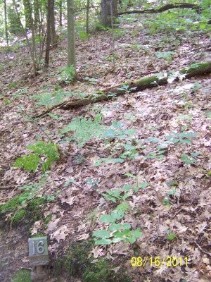
Post 16: Witch-hazel arches over the trail and blooms in the autumn. If you are out for a walk in October or November, look for its yellow narrow leaved flowers along its branches. Little star flowers (Trientalis borealis) bloom white “stars” in the spring. Along the trail in the autumn, look for some coral-shaped fungi (Clavaria) that are either bright reddish orange or tan. If the fungi are greenish or purplish, it may be one of the many varieties of Russula. Fungi are NOT plants and cannot produce their own food as plants, but instead must obtain carbohydrates by decomposing organic substances with their mycelia. Also in this area, look for a small plant that has two triers of whorled leaves. Its name is Indian cucumber root (Medeola virginiana).
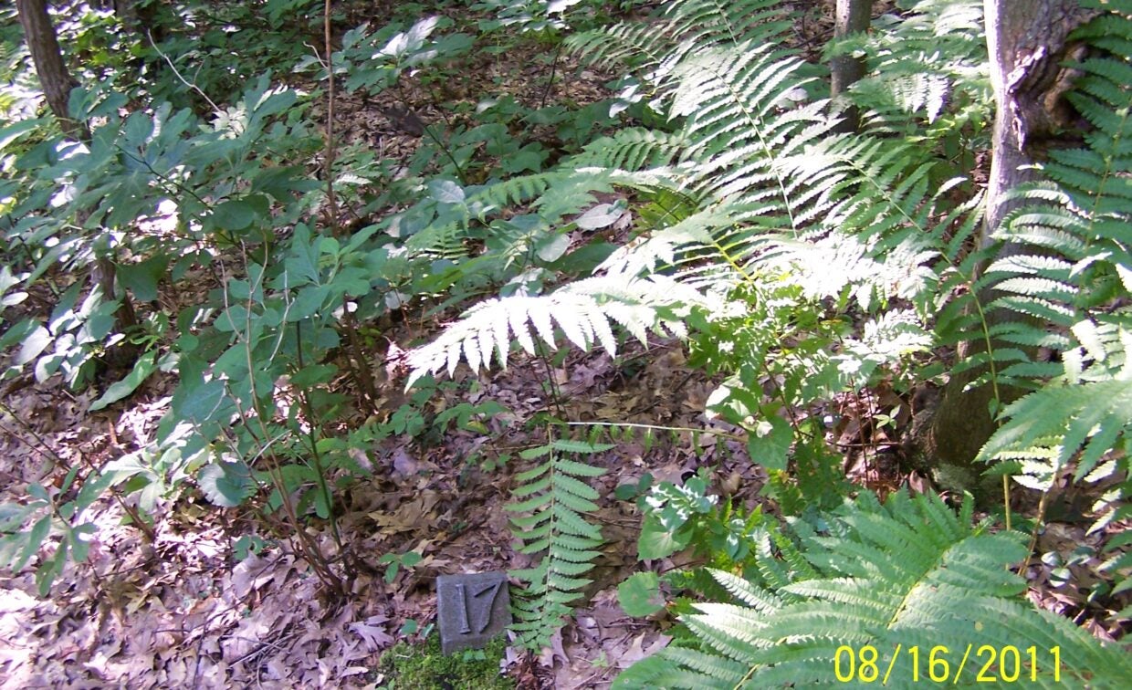
Trail Marker 17: Mayapple & Fern
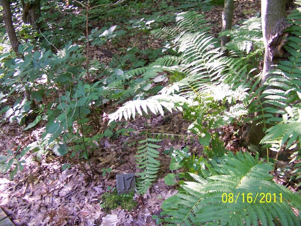
Post 17: If you are hiking in the spring, what is the name of the plant with the large umbrella-like leaves on the wetland side of the trail? The mayapple (Podophyllum peltatum). Look along the edge of the creek. Do you notice some overturned trees that fell during some powerful straight line winds? This disturbed site is now a new microhabitat for organisms. Look up in the large trees—perhaps you will see a large bundle of leaves near the top of one. This may be either an old fox or gray squirrel nest.
Trail Marker 18: Ferns Growing in the Natural Area
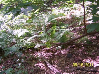
Post 18: Other ferns that may be found in the wetland area besides cinnamon fern are interrupted fern (Osmunda claytoniana), royal fern (Osmunda regalis var. spectabilis), and sensitive fern (Onoclea sensibilis). Many of the ferns can become at least three feet tall. Beware of poison ivy (Toxicodendron radicans) along the trail, especially along the creekside. Poison ivy is three leaved and slightly lobed and can be differentiated with other leaves of three, such as the blackberry – in that that blackberry has much more jagged or toothed edges on its leaves. To the left and before crossing the bridge, you may see clubmoss, skunk cabbage, elderberry, and Trillium.
Trail Marker 19: Liverwort
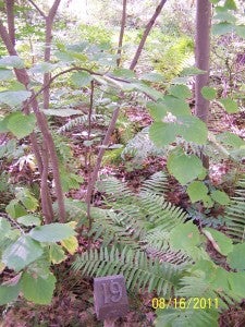
Post 19: In the very moist microhabitat along the creek, a liverwort (Marchantia) grows and looks like a green flat leaf-like plant. Liverworts usually grow in the wet habitats. Do you see the ferns, witch-hazel, and maples? Ducks, muskrats, and raccoons have been seen in or near the creek. Do you see any tracks in the sand along the creek?
Trail Marker 20: View of Current Access Road
Post 20: Red maples abound and so does poison ivy (Toxicodendron radicans) near the current access road ahead. Behind you is an old roadbed between the creek and the upland habitat. This area had been cut over, bulldozed and burned during the early 1960s when the college was built. Assuming disturbance will not continue, this is an excellent chance to observe natural succession. This is nature’s process of change. Such sun tolerant plants as chickweed, goldenrod, Canada thistle, dandelions were common in the 1970s, but as the habitat became less suited to them and more suited to shade-tolerant plants, shade tolerant plants such as ferns slowly replace the sun-tolerant plants. Animals associated with the succession of plants will also change. The Eastern mole (Scalopus aquaticus) has been seen and some years ago were live trapped along the banks of the old road bed. This mole, with broad feet and sharp claws is well adapted to capturing insects in the ground. At times, the Eastern box turtle (Terrapene carolina carolina) may be seen as you approach the upland area.
If you want to take the shortcut to the beginning of the trail continue on the dirt trail on the left. Or proceed to the right on the current path toward the college building and turn left on the access road to go to the parking lot. We hope you have enjoyed your walk and will return for another visit!
If you want to take the shortcut to the beginning of the trail continue on the dirt trail on the left. Or proceed to the right on the current path toward the college building and turn left on the access road to go to the parking lot. We hope you have enjoyed your walk and will return for another visit!